Mullerthal Trail
Sections
For individual tour planning
Sections for individual tour planning
Create your own adventure!
The Mullerthal Trail gives you the opportunity to set up your own personalized tour.
Immerse yourself in the diversity of this trail by combining the stages according to your own pace and interests. Along the way, you will find accommodations not only in Echternach, Mullerthal, Larochette and Moersdorf, but also in Beaufort, Berdorf and Scheidgen.
Here is the Mullerthal Trail in sections. Discover the fascinating facets of the trail through these descriptions and create your own tour, customized according to your preferences .
All sections of the Mullerthal Trail
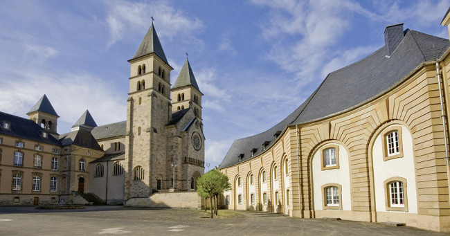
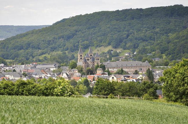
The city of Echternach, which next to the St Willibrord Basilica (1) offers the abbey and the historical old town as well as numerous other attractions, is the starting point of this section. The Mullerthal Trail starts at the Basilica in Echternach and first runs through the yard of the abbey to the municipal park and then along the river Sûre. Shortly behind Echternach, the Mullerthal Trail leaves the river and leads up into the woods - past the impressive rock formations Veitcheslee, Roudeschlëff and Alkummer (2). Above Steinheim, the hiker enjoys a spectacular view on the valley of the Sûre before the Mullerthal Trail plunges again into the forest. The path then leads across open fields to the village of Rosport, known, among other things, for its mineral water source as well as for the Musée Tudor (3).
Duration: 3h
Tourist Info Echternach
9-10, Parvis de la Basilique | L-6486 Echternach
Tél : +352 72 02 30 | Fax : +352 72 02 30
E-mail : touristinfo@visitechternach.lu
Tourist Info Rosport
1, rue du Camping | L-6580 Rosport
Tél : +352 73 01 60
E-mail : campingrosport@pt.lu
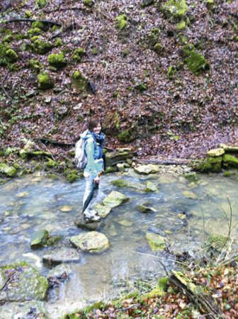
From the Musée Tudor (1), you continue on the Mullerthal Trail. Idyllic forests, wonderful panoramic views and mossy rock formations alternate until the first stop: the pilgrimage chapel of Virgin Mary in Girsterklaus (2) which dates from the 14th century. The Girsterklaus is the oldest pilgrimage site in the country and was created from building materials from the region. From Girsterklaus, the Mullerthal Trail leads down into the valley of Girsterbaach (3), which has cut deep in the dolomite rocks at this point. The path crosses the stream for several times until it leads uphill into the Burerbësch. At the end of this section, the hiker will enjoy a varied landscape which is characterized by shrubs, hedgerows, dry stone walls and enchanting small forests. At the next crossing, the path leads downhill towards Moersdorf (4).
Duration: 3,5h
Tourist Info Rosport
1, rue du Camping | L-6580 Rosport
Tél : +352 73 01 60
E-mail : campingrosport@pt.lu
From Moersdorf, the Mullerthal Trail first winds through the nature reserve of Déiwelskopp (1) with its different forest types such as high, low and ravine forest and calcareous dry grasslands with a multitude of species. After a steep ascent to the plateau, the hiker will be rewarded with magnificent views on the Sûre and even onto the Moselle. From here, the hiker continues across open agricultural land until behind Mompach (2). The village has managed to preserve its rural character and its appeal by the disclosure of the Klengelbaach. The Mullerthal Trail crosses the village center and then leads through the forest called Honsréck in the direction of Herborn. Shortly after the forest, the hiker enjoys wonderful panoramic views on the village of Herborn (3).
Duration: 3h
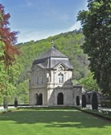
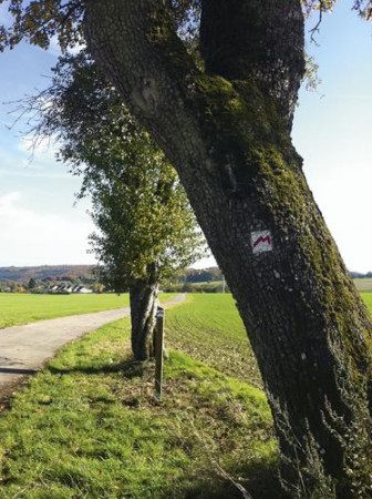
The starting point of this section is the square in front of the church in Herborn. Herborn (1) is a very nice village thanks to the well-preserved historical buildings and the imposing church. The Mullerthal Trail first leads out of the village and after a short time into the natural forest reserve of Hierberbësch (2), which, with his beech occurrence, is one of the typical representatives of central European forest communities. In the nature forest reserve, you should sit down on the bench to listen to the soothing sounds of the forest. The Mullerthal Trail then leaves the forest again, providing the hiker with a great view over open fields. From there, “the red M” takes the hiker on the way towards Haard forest. The next highlight is the lake of Echternach (3). After leaving this leisure zone, the path runs through an alley past St. Mary’s Chapel (4) to the center of Echternach (5).
Duration: 3,5h
Tourist Info Echternach
9-10, Parvis de la Basilique | L-6486 Echternach
Tél : +352 72 02 30 | Fax : +352 72 02 30
E-mail : touristinfo@visitechternach.lu
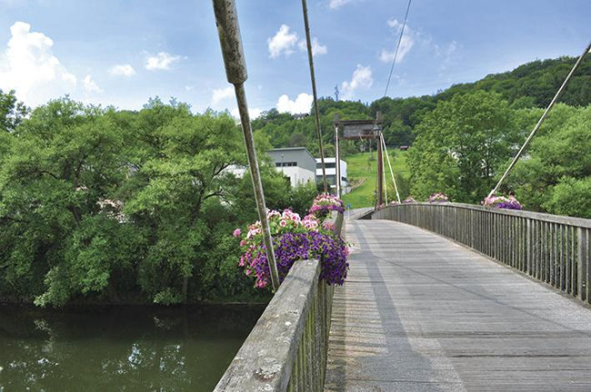
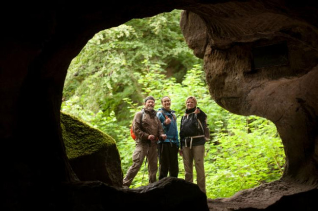
From the market place in Echternach, the Mullerthal Trail leads through the pedestrian zone and then up to the view point called Trooskneppchen (1). From there, you enjoy an impressive view on the city of Echternach. The trail passes subsequently through the woods until the Wollefsschlucht (2) - a steep crevice where wolves found refuge in earlier times. The next highlight on this section is the Labyrinth (3) - a maze of rock masses. Along the Aesbach, the Mullerthal Trail passes along the big rocks of Perekop, which can be explored by climbing up ladders. You pass on a special bridge construction at Chipkapass (4). After this, Huel Lee (5) is not far away - a cave where the regional mill stones were broken, which is still clearly recognizable by the circular bulges. Shortly afterwards, you reach the amphitheater, an open-air theater, used for various events. After a few more meters, the village of Berdorf, known among others for its cheese, is visible.
Duration: 2 - 2,5 h
Tourist Info Echternach
9-10, Parvis de la Basilique | L-6486 Echternach
Tél : +352 72 02 30 | Fax : +352 72 02 30
E-mail : touristinfo@visitechternach.lu
Tourist Info Berdorf
5, Beim Martbusch | L-6552 Berdorf
Tél : +352 28 67 15 21
E-mail : info@visitberdorf.lu
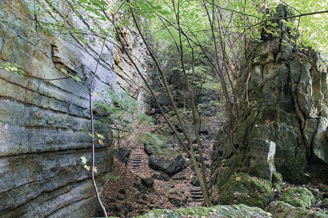
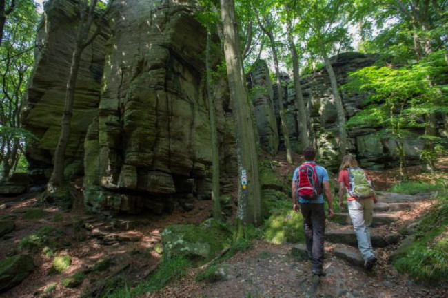
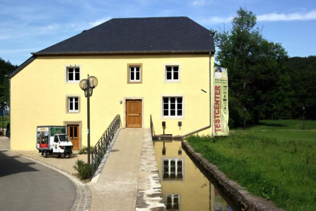
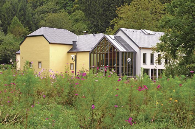
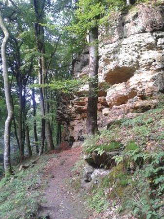
The center of Berdorf, surrounded by rocks, lies on a plateau and is the starting point of this section. From there, the Mullerthal Trail first runs through the locality and then into its rocky landscape that impresses by massive cliffs, gorges and caves. The route leads along the romantic valley of Ruetsbaach and passes over small bridges towards Ruetsbechschlëff (1). A trip to the plateau of Ruetsbechschlëff is recommended. In the following section, further rocky highlights are lined up - including Binzeltschlëff (2), Priedegtstull (3) and Werschrummschlëff (4). During the second half of the section, you pass through the natural forest area called Nature forest Schnellert, a beautiful and wild part of the Mullerthal Trail. The Heringer Millen (5) in the village of Mullerthal is the arrival of this stage. This mill used to be one of the major mills in the region and now houses a tourist center and a restaurant.
Duration: 2 - 2,5h
Tourist Info Berdorf
5, Beim Martbusch | L-6552 Berdorf
Tél : +352 28 67 15 21
E-mail : info@visitberdorf.lu
Touristcenter Heringer Millen
1, Rue des Moulins | L-6245 Mullerthal
Tél : +352 87 89 88 | Fax : +352 26 78 40 45
E-mail : info@mullerthal-millen.lu
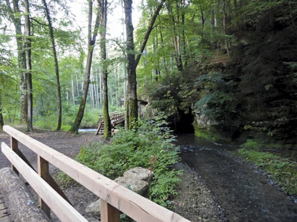
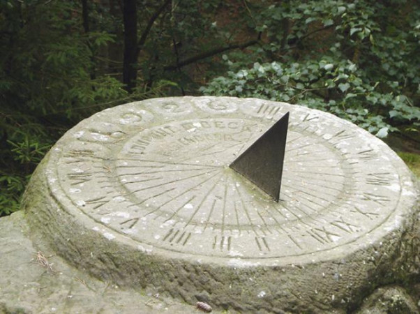
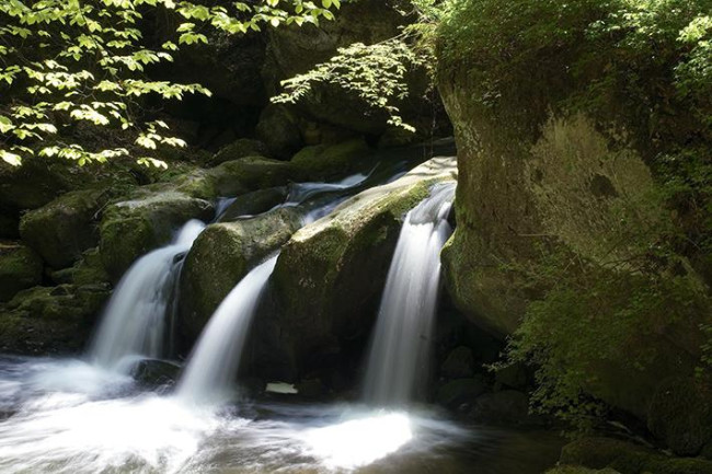
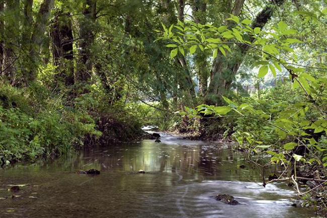
The Black Ernz is the recurring companion of this route. From the starting point at the Heringer Millen, the Mullerthal Trail follows the course of this stream to the picturesque waterfall Schéissendëmpel (1). You cross the Black Ernz here and above the brook the route runs along a narrow path directly along the slope. After a few meters, there is a spectacular passage over a nearly 90 m long and seemingly floating staircase construction (2). You continue, following the stream, into the Paaschent forest. After a few meters, the Mullerthal Trail leaves the creek and leads up into the forest for a certain while until it goes down the steps to Kallektuffquell (3). Here the Black Ernz is very close again. The Mullerthal Trail now runs parallel to the creek on a wooden bridge that crosses it several times. At the end of the bridge, the Mullerthal Trail leads uphill towards Marscherwald known as peaty, light beech wood. In the following section, the Mullerthal Trail crosses the Rippsmuer (4) - a high moor - and the Sonnenauer (5), a sundial, chiseled in a rock. The walk continues towards Blumenthal, where the Mullerthal Trail meets the Black Ernz again.
Duration: 3h
Touristcenter Heringer Millen
1, Rue des Moulins | L-6245 Mullerthal
Tél : +352 87 89 88 | Fax : +352 26 78 40 45
E-mail : info@mullerthal-millen.lu
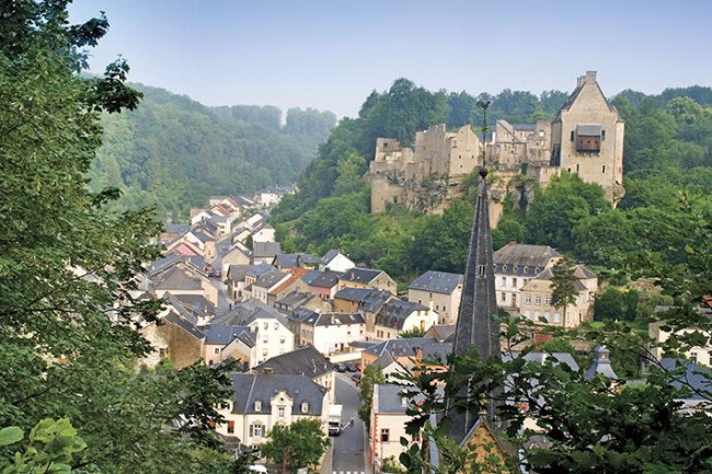
This section of the Mullerthal Trail leads from the Black to the White Ernz. The starting point in the village of Blumenthal is located on the Black Ernz. From Blumenthal, the Mullerthal Trail runs up through the forest towards Heffingen. Once on the plateau, you will have an open, agricultural embossed stretch to make. The viewpoint Houbierg (1) offers top long-distance views over fields and meadows. The Mullerthal Trail then leads through a forest with charming rock sections down into the valley of the White Ernz. In parallel to the stream, it continues to Supp (2). Behind the village, the Mullerthal Trail leaves the stream, leads up to the forest and on beautiful narrow paths towards Larochette. The huge ruins of the castle of Larochette (3), which lies above the village, already welcome you from far. Arrived in Larochette, the path leads down to the village, next to the White Ernz.
Duration: 3h
Tourist Info Larochette
25, Chemin J.A. Zinnen| L-7626 Larochette
Tel : +352 26 87 09 68
E-mail : info@visitlarochette.lu
From castle to castle is the motto of this section of the Mullerthal Trail. The starting point is the Place Bleech in Larochette. The Mullerthal Trail crosses the square and leads behind the church up to the woods. After a short but steep climb, you enjoy a final glance on the castle (1). From there, the trail first passes through a light beech forest and continues to rise up to the plateau to an open landscape - past meadows, fields and farms. After a short forest followed by a tail-lined section at the end, you reach the highest point of the hike. Once there, a 360° panoramic view (2) rewards you for the constant rise. Thereafter the hike goes through a forest path up to Berens. Here the Mullerthal Trail develops into a narrow path that leads to Aleweier (3), on the banks of which a picnic area invites the hikers to rest. The path then runs along rock formations to an old washing area, the Klingelbuer (4). You continue on a wooden footbridge: at this point, you see the destination of your tour - Beaufort Castle (5).
Duration: 4h
Tourist Info Larochette
25, Chemin J.A. Zinnen | L-7626 Larochette
Tel : +352 26 87 09 68
E-mail : info@visitlarochette.lu
Tourist Info Beaufort
87, Grand-Rue | L-6310 Beaufort
Tel : +352 83 60 99 300 | Fax: +352 86 94 14
E-mail : info@visitbeaufort.lu
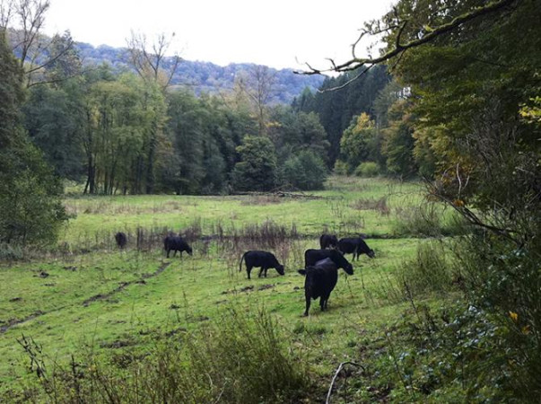
This section of the Mullerthal Trail inspired by the elements of rocks, forest and water is particularly interesting. The starting point is near the imposing castle ruins of Beaufort (1) which date from the 12th century. Right behind the ruins, there is a Renaissance castle (2) from the 17th century, where the famous Cassero, a blackcurrant liqueur is still produced today and offered for tasting. The Mullerthal Trail runs beside the pond opposite the castle into the woods and leads along the banks of the wild, romantic Haupeschbaach (3) which determines, together with the moss-covered rocks, the character of this section. After a short time, the Haupeschbaach meets the Halerbaach (4). There are many small wooden bridges here that cross the creek and an extraordinary, moss-covered rocky landscape. After a few kilometers, the trail leaves the forest and runs into the beautiful open valley of the Black Ernz. On the meadows along the meandering creek you can see Black Angus cattle grazing most of the year. The trail then passes through an idyllic landscape along the forest to the next destination - the Heringer Millen (5) in the village of Mullerthal.
Duration: 2,5h
Tourist Info Beaufort
87, Grand-Rue | L-6310 Beaufort
Tel : +352 83 60 99 300 | Fax: +352 86 94 14
E-mail : info@visitbeaufort.lu
Touristcenter Heringer Millen
1, Rue des Moulins | L-6245 Mullerthal
Tél : +352 87 89 88 | Fax : +352 26 78 40 45
E-mail : info@mullerthal-millen.lu
From the Heringer Millen (1), the Mullerthal Trail runs in the direction of Schéissendëmpel (2) where he crosses the road and climbs into the forest. From there narrow paths, completely surrounded by impressive cliffs, lead to rocks with imaginative names like Eilebuerg (3), Goldfralee (4) or Goldkaul (5). A whole series of myths and legends are being told of these bizarre rock formations. The Mullerthal Trail passes along the Konsdrëffer Millen and continues through the forest to the crevices of Rittergang (6), Déiwepëtz (7) and the pitch-black canyon Kuelscheier (8). Behind Kuelscheier the trail continues through forests and rocky landscapes towards Hersberg. Just before the village, you can continue or select a shortcut to go to Scheidgen. If you follow the path towards Hersberg, you get to Bildchen (9), a thousand year old oak.
“Déiwepëtz” and “Rittergang” cannot be bypassed. You should think in any case of a flashlight. To experience the Kuelscheier, you have to leave the Mullerthal Trail briefly to explore this adventurous rocky cave.
Duration: 3h
Touristcenter Heringer Millen
1, Rue des Moulins | L-6245 Mullerthal
Tél : +352 87 89 88 | Fax : +352 26 78 40 45
E-mail : info@mullerthal-millen.lu
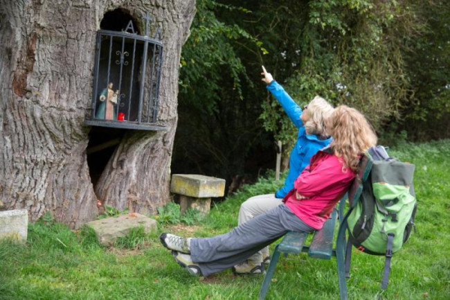
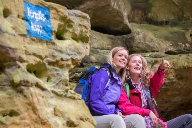
From the starting point in Hersberg, the Mullerthal Trail leads first to Bildchen (1), an ancient oak, which houses a small statue of Virgin Mary. A relatively steep narrow path leads then parallel to Steebach on the plateau surface. At the foot of the steep cliff, prehistoric grinding grooves can be seen. The sandstone has been used to grind the stone tools. From there, the Mullerthal Trail runs through a beautiful landscape with forests, rocks and open areas. After crossing the road, you pass along the Méchelskierch (2), a rock cave that, according to the traditions of the end of the 18th century, is said to have been a hermitage. From this point, the Mullerthal Trail passes first through a wooden area and then after a few kilometers, further on narrow paths, past impressive rock formations such as Dachselee (3), Einsiedelei (4) or Herrgottskapp (5). With a little imagination, you can recognize fairytale figures in the rocky walls. Scheidgen is the destination of this stage.
Duration: 3h
Tourist Info Consdorf
33, Rue Buergkapp | L-6211 Consdorf
Tél : +352 79 02 71 | Fax : +352 79 90 01
E-mail : info@campconsdorf.lu
The starting point is the Veräinshaus in Scheidgen. From there, the Mullerthal Trail leads first out of the village into the next forest called Juckebësch (1). Light beech forests, narrow paths and seasonal waterways which are dependent on the water balance disappear or evolve into rushing streams characterize this section. You may recognize many faces in the rocks right and left of the path. After passing the hiking parking Leiwerdëlt, the Mullerthal Trail goes for a short distance along the creek before it runs into Leiwerdëlt (2), a beautiful wooded area. The trail continues along the stream next to rocky cliffs, and continues on narrow paths with rocky sections by light deciduous forests until Echternach. Before going downhill, you enjoy a beautiful view on the abbey town (3).
Duration: 3h
Tourist Information Consdorf
33, Rue Buergkapp | L-6211 Consdorf
Tél : +352 79 02 71 | Fax : +352 79 90 01
E-mail : info@campconsdorf.lu
Tourist Info Echternach
9-10, Parvis de la Basilique | L-6486 Echternach
Tél : +352 72 02 30 | Fax : +352 72 02 30
E-mail : touristinfo@visitechternach.lu
